Another popular form of motoring and cycling maps of the time were the Gall and Inglis strip maps, that covered the Land’s End to John O’Groats route in three sections. Following the strip map was much like following the line on a modern day sat nav – the information similarly confined to the depicted route and immediately surrounding area.
Between the late 1800s and the establishment of motorcycling as a popular pastime pre-WWI, the pioneering motorcyclist enjoyed the introduction of maps that specifically catered for the full exploration of the network of minor highways. In addition to the maps, the British trail rider enjoyed the world’s first motorcycling magazine, ‘The Motor Cycle’, launched in 1903. The Motor Cycle featured an abundance of readers’ letters and articles that discussed roads and celebrated the exploration of new roads, often with direct reference to commercially available motoring maps. Popular motorcycling maps included Bartholomew and Autocar Maps, together with the Michelin Guides. Bartholomew marked its motoring maps to show the passability of roads. Many of the recommended roads are present day Green Roads.
The mapping of roads encouraged the exploration and use of the public carriageway network. Beyond the maps, the motoring and wider media worked hand in hand with the mapping, celebrating the revival of the countryside (especially the roadside inn) by the public benefit of motoring.
Road numbering and classification was introduced in the 1920s, and this was conveyed to the motoring public by Ministry of Transport Road Maps, published by Ordnance Survey. Those maps showed the many minor and unsurfaced Green Roads in the same manner as the rest of the road network. A and B roads were shown with their respective numbers.
Green Roads continued to be shown as roads on Ordnance Survey and other road maps and were managed as one status – public carriageway (either an Unclassified County Road (UCR) where repairable at public expense, or as a Ratione Tenurae road (RT) where repairable at private expense – RT Green Roads are rare).
Motoring organisations (such as the RAC and AA) had substantial influence over public mapping and the depiction of green and other roads. They published their own maps and endorsed others, influencing the content (e.g. Bartholomew).
The National Parks and Access to the Countryside Act 1949 introduced the new classification of Road Used as Public Path (the “RUPP”) and the Definitive Map (that has never been definitive). RUPP classification was used on a Local Authority public map to show that a road had rights for pedestrians and equestrians, but that rights for vehicles were open to question.
The RUPP classification was then liberally applied to established Green Roads, the effect of which was the diluting of their status and reputation as public carriageways (as the new RUPP classification provided scope to infer that status was in question). Further, the Definitive Map was systematically used to under-record Green Roads as bridlepath or footpath, and so present them as illegal for motorcycle use.
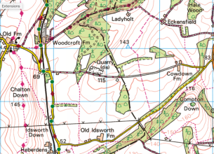
The Ordnance Survey (OS) mapping was used to publicise the recorded RUPP’s, bridlepaths and footpaths, with the effect that from the 1950s the OS maps in common use – which have no legal authority – were used to mislead the public as to the status of Green Roads and lawfulness of motorcycle use on the same.
By the late 1960s the problem had been escalated, in no small part due to anti public access pressure groups seeking to ban motorcycles from using RUPPs and beyond. Government tasked a committee to investigate and report.
This resulted in the recommendation of the Gosling Report that RUPPs be removed from the public maps, with all Green Roads being managed under the one status of UCR. That recommendation was conducive to motoring interests and would have returned mapping to the one status depiction for Green Roads, that was enjoyed prior to 1950.
But Government departed from that recommendation and made legislation (The Countryside Act 1968) to introduce a third classification – the Byway Open to All Traffic (BOAT), further confusing the status of Green Roads.
The TRF was formed in 1970 in direct response to the Countryside Act 1968 as trail riders foresaw the confusion and detriment that would arise from having three classifications (UCR, RUPP, BOAT) shown on public maps.
If that wasn’t enough, a fourth classification was introduced in the 1990s, the – Other Route with Public Access (ORPA). This was used to depict some UCRs while others that were not shown as ORPAs were left white on the OS maps and became known as White Roads – a fifth classification!
We entered the Noughties with the status of Green Roads deliberately confused and diluted with no less than five classifications shown on the Local Authority and other public maps. Undeterred, the government invented a sixth classification (in 2000), the Restricted Byway – this would be used to show Green Roads where public rights for non-motorised traffic existed, but (car and) motorcycle use was (now) illegal.
The deliberate use of mapping to confuse and dilute the status and reputation of Green Roads was a significant factor that led to the creation of the Restricted Byway classification and ultimately the Natural Environment and Rural Communities (NERC) Act in 2006, which extinguished car and motorcycle access to a vast swathe of established Green Roads. The mechanism of the NERC Act was focused on public mapping, where it represented Green Roads as a diluted and confused classification. The Green Road network was best protected pre-1949, when public mapping simply showed the roads at the one status.
NERC reduced the number of classifications of Green Roads shown on public maps, but four different classifications are still shown. This still allows those that want to restrict public access, based on their terms, plenty of scope to confuse and mislead the public as to the status and reputation of Green Roads. Today’s public mapping continues to be a threat to the erosion of public access when it comes to the Green Road Network.

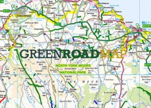
The Green Road Map is a ground breaking project to create a digital archive to safeguard the future or Trail Riding…

The TRF recognises that motor vehicle use on Green Roads requires managing – as is the case for all highways…

Examples of how current public mapping of Green Roads works to the detriment of of public access…
Trail Riders Fellowship
Registered in England and
Wales No. 05848933
218 Strand London WC2R 1AT